Add Qt Location and Positioning Modules
To use any map or location features, make sure to add the QtLocation and QtPositioning modules to your project, by adding an additional find_package() statement to your project's CMakeLists.txt file:
 ...

 find_package(Felgo REQUIRED)

 # Add Qt location and positioning module
 find_package(Qt6 COMPONENTS Location Positioning REQUIRED)

 ...
Felgo then automatically links and deploys all required libraries to your app.
Display a Map
The AppMap component is an extension of the QML Map item and can display a map and optionally the user location.
To actually display the map, it is required to specify a Plugin that provides the map data. QML currently supports the following plugins:
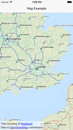
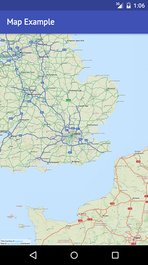
The following example creates a Map that uses the Maplibre Map plugin:
| iOS |
Android |
|
|
|
import Felgo
import QtLocation
App {
NavigationStack {
AppPage {
title: "Map Example"
AppMap {
anchors.fill: parent
plugin: Plugin {
name: "maplibre"
parameters: [
PluginParameter {
name: "maplibre.map.styles"
value: "https://api.maptiler.com/maps/streets/style.json?key=get_your_own_OpIi9ZULNHzrESv6T2vL"
}
]
}
}
}
}
}
Show Markers on a Map
The AppMap component allows to show a map and optionally the user location. It is based on the QML Map item.
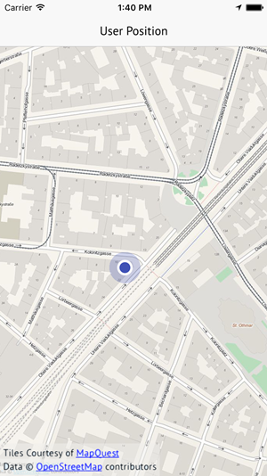
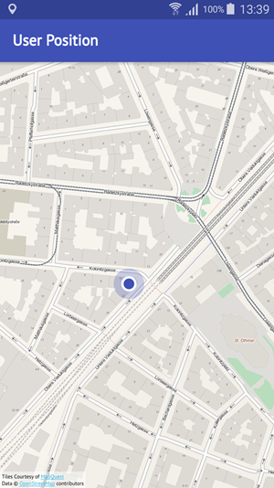
Show User Position
The AppMap already comes with a built-in feature to detect and display the user location. Set the AppMap::showUserPosition property to
true to enable this feature. The app then tries to detect the user location and displays a marker on the map if possible. The position can only be displayed if the device is capable of getting a
position from either GPS or other position sources.
Note: Also make sure to add required configuration settings to AndroidManifest.xml on Android or the Project-Info.plist on iOS so your app may access gps
location on the device.
The following example detects and displays the user location:
| iOS |
Android |
|
|
|
import Felgo
import QtLocation
import QtQuick
App {
NavigationStack {
AppPage {
title: "User Position"
AppMap {
anchors.fill: parent
plugin: Plugin {
name: "maplibre"
parameters: [
PluginParameter {
name: "maplibre.map.styles"
value: "https://api.maptiler.com/maps/streets/style.json?key=get_your_own_OpIi9ZULNHzrESv6T2vL"
}
]
}
showUserPosition: true
zoomLevel: 13
Component.onCompleted: {
if(userPositionAvailable)
center = userPosition.coordinate
}
onUserPositionAvailableChanged: {
if(userPositionAvailable)
zoomToUserPosition()
}
}
}
}
}
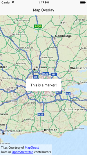
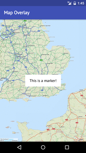
Custom Overlay Items
There are several overlay items that can be placed on a map, for a list of all possible overlay items see here. The
MapQuickItem type allows to place custom QML items on the map, which is what we will use for this example. The following QML code creates a
map with a custom overlay at its center:
| iOS |
Android |
|
|
|
import Felgo
import QtLocation
import QtPositioning
import QtQuick
App {
NavigationStack {
AppPage {
title: "Map Overlay"
AppMap {
anchors.fill: parent
center: QtPositioning.coordinate(48.2082,16.3738)
plugin: Plugin {
name: "maplibre"
parameters: [
PluginParameter {
name: "maplibre.map.styles"
value: "https://api.maptiler.com/maps/streets/style.json?key=get_your_own_OpIi9ZULNHzrESv6T2vL"
}
]
}
MapQuickItem {
coordinate: QtPositioning.coordinate(48.2082,16.3738)
anchorPoint: Qt.point(sourceItem.width/2, sourceItem.height/2)
sourceItem: Rectangle {
width: dp(180)
height: dp(50)
color: "white"
radius: dp(10)
AppText {
text: "The heart of Vienna!"
anchors.centerIn: parent
}
}
}
}
}
}
}
How do I access GPS or other device sensors?
Felgo allows you to access various device sensors, with the Qt Sensors QML Types.
The components for Positioning, Maps, and Navigation are found in the Qt Positioning and Qt
Location modules.
For example, you can also use the QML PositionSource type to retrieve the GPS position. The AppMap::showUserPosition feature internally uses PositionSource as well.
More Frequently Asked Development Questions
Find more examples for frequently asked development questions and important concepts in the following guides:


